The Michigan Copper Mines
Isle Royale & Keweenaw Peninsula, USA · not visited
Thousands of hand-dug pits, and a date that depends on what you decide to date. The lake mud says mining at Isle Royale began about 6,500 years ago and stopped abruptly about a thousand years later.
- Latitude
- 47.9975° N
- Longitude
- 88.9088° W
- Isle Royale signal
- c. 6,500 to 5,400 BP
- Copper artefacts
- 8500 to 3580 cal BP
- Open questions
- 4 logged
A thousand years of lead in the lake mud
At McCargoe Cove on Isle Royale, a sediment core records something that no excavation of the mine pits has managed: a clear date. David Pompeani and colleagues at the University of Pittsburgh found lead pollution in the lake mud starting about 6,500 years ago, running for roughly a thousand years with the mining boom peaking about 6,000 years ago, and then ending abruptly. Lead pollution did not return until the mid-1800s.
The pits cannot be dated directly. The lake can.
The pits themselves are not the problem. They are everywhere.
What is actually there
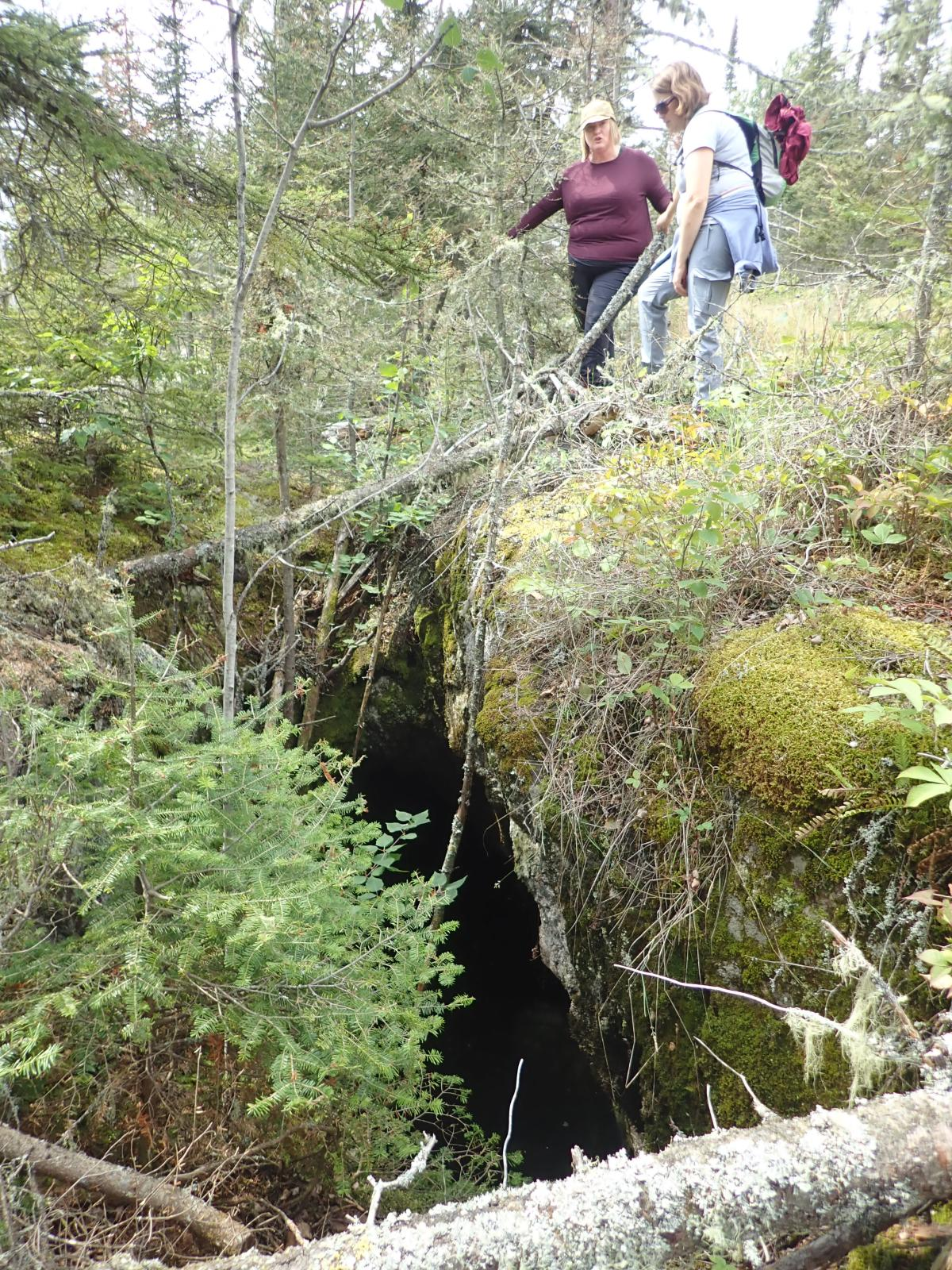
On Isle Royale, a rugged island in Lake Superior, and along the Keweenaw Peninsula on the Michigan mainland, the ground is riddled with ancient pits and trenches, dug by hand without metal tools. It is among the largest concentrations of prehistoric copper extraction known anywhere.
The copper is unusual. It occurs as native copper, nearly pure metal, sitting close to the surface in a form that could be broken out with stone hammers instead of smelted from ore. Few places on earth offered metal this accessible to people without furnaces.
The people responsible are generally identified as the Old Copper Complex, an Archaic-period tradition across the Great Lakes region. They made awls, knives, spear points, fish hooks and ornaments, worked by cold-hammering and annealing instead of casting.
The date that moved
Earlier versions of this page said mining ran from about 3000 to 1200 BCE and stopped abruptly then. That figure came from radiocarbon dates on wooden tool handles found in the pits, and it does not survive the newest work.
In 2021 Pompeani and colleagues compared 53 radiocarbon dates tied to copper artefacts and mines, eight of them new, against six lake-sediment chronologies. Organic material embedded in 15 Old Copper Complex artefacts ranges from about 8500 to 3580 calibrated years before present, and those artefact dates sit in the same period as the lead pollution in the lakes. The dates from the mines and from stratigraphic contexts are younger, and the authors read them as reflecting the mines filling in after abandonment, not active use.
That is a familiar trap. A date on wood inside a pit tells you when the pit filled, not when it was dug. It is the same problem that undid the Gunung Padang paper, and that complicates the burial question at Göbekli Tepe.
How much, and the number that will not settle
In 1961 Drier and Du Temple published an estimate, based on the total volume of the mine pits, that as much as 1.5 billion pounds of copper had been extracted. It has been repeated everywhere since, and it is the number behind most claims that the copper vanished or was taken overseas.
It is also disputed by archaeologists who study the region. Susan Martin and others have argued that it rests on exaggerated assumptions about pit volume and extraction efficiency, and that the true total is unknown. I have not read the critique in full. No comprehensive modern survey of the pits has been completed. The lake record gives an independent handle, but it is inferred from chemical indicators and measures activity, not output.
The popular version asks where the missing copper went. What if the copper is not missing at all, and the question is badly formed because it starts from a number that nobody can defend?
Why it is worth asking: because a huge, uncertain total produces a vanished-metal mystery, and a smaller one produces a trade network. What supports the smaller reading: copper from the Great Lakes turns up at Poverty Point in Louisiana, as a 2025 study of that site notes, and Old Copper Complex artefacts appear well beyond the Great Lakes, so the metal clearly travelled. Hammered copper is also easy to rework, which leaves little behind. What speaks against it: nobody has an inventory of the copper that left the district, so the case is only as good as the figures. What would tell the readings apart: trace-element sourcing of artefacts across the continent, set against estimates of output built from the pollution record. I have not seen a continent-wide result. What stays unknown is how much metal the system moved, and what it was for.
What is still open
How much copper actually came out of the ground?
Any figure presented as settled, in either direction, overstates the evidence. A modern survey of the pits, and a calibration linking the pollution record to the weight of metal removed, would give the first honest range.
Why did the Isle Royale pollution end so abruptly?
The authors speculate that easily accessible veins were exhausted and that a drier climate may have played a part, but they do not know. Artefact dates continue to about 3580 cal BP, so working of copper went on, at least elsewhere in the region. Sediment cores from other lakes near the Keweenaw mining district would show whether mining moved or stopped.
Where did the finished copper go?
Old Copper Complex tools and ornaments turn up far from the Great Lakes, evidence of a real, functioning exchange network. Whether it fully accounts for the scale of extraction cannot be answered while the scale is unknown. Chemical fingerprinting of artefacts is the way to tie metal to source.
How were the pits dug, and by whom?
As I understand the accepted account, the rock was cracked by fire-setting, heating it and cooling it quickly, then broken with stone hammers. The organisation and duration of labour that sustained this over centuries, by a population without a permanent monumental settlement nearby, is still being worked out. Settlement and seasonal-camp evidence near the pits would help.
Sources
- Pompeani, D.P. et al., “Ancient mining pollution in early to middle Holocene lake sediments from the Lake Superior region, USA”, The Holocene, 2015. Summarised in Eos, “Miners left pollution trail in Great Lakes 6,000 years ago”.
- Pompeani, D.P., Steinman, B.A., Abbott, M.B., Pompeani, K.M., Reardon, W., DePasqual, S. and Mueller, R.H., “On the Timing of the Old Copper Complex in North America: A Comparison of Radiocarbon Dates from Different Archaeological Contexts”, Radiocarbon 63(2), 2021, pp. 513 to 531. I read the abstract only.
- Drier, R.W. and Du Temple, O.J., Prehistoric Copper Mining in the Lake Superior Region, 1961, the original high estimate of total extraction.
- Martin, S.R., Wonderful Power: The Story of Ancient Copper Working in the Lake Superior Basin, on the critique of that estimate and the archaeology of the Old Copper Complex. Not re-read.
- Kidder, T.R. and Grooms, S., 2025, on Poverty Point, as reported by Washington University in St. Louis, for Great Lakes copper at that site.
- US National Park Service, Minong Mine Historic District and Keweenaw National Historical Park documentation. NPS, “Indigenous mining”: the pit photograph on this page. The NPS disclaimer says material created by NPS staff as part of their duties is generally public domain, and that some content may belong to third parties. The photo is credited “NPS photo” on the article, with no third-party credit. I took the image address from the page source and have not been able to open the image itself, so the description follows the NPS caption.
Not visited in person. Written from published archaeological and geochemical sources. Last reviewed 12 October 2026. Corrected on this date: an earlier version gave 3000 to 1200 BCE for the mining and an abrupt stop around 1200 BCE, which rested on dates from inside the pits. The chart on this page is an original illustration drawn from the dates in the text. The page has no photograph.